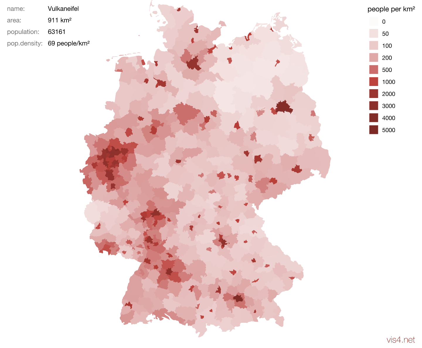
Mapping Population Density in Germany
I remember being very proud when I made my first interactive map in Flash! I got around learning about geo-data and map projections and all that by just loading an SVG file of pre-projected German administrative districts.
Appeared on vis4.net