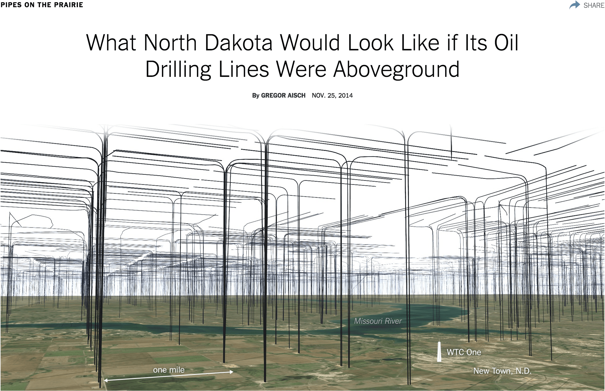
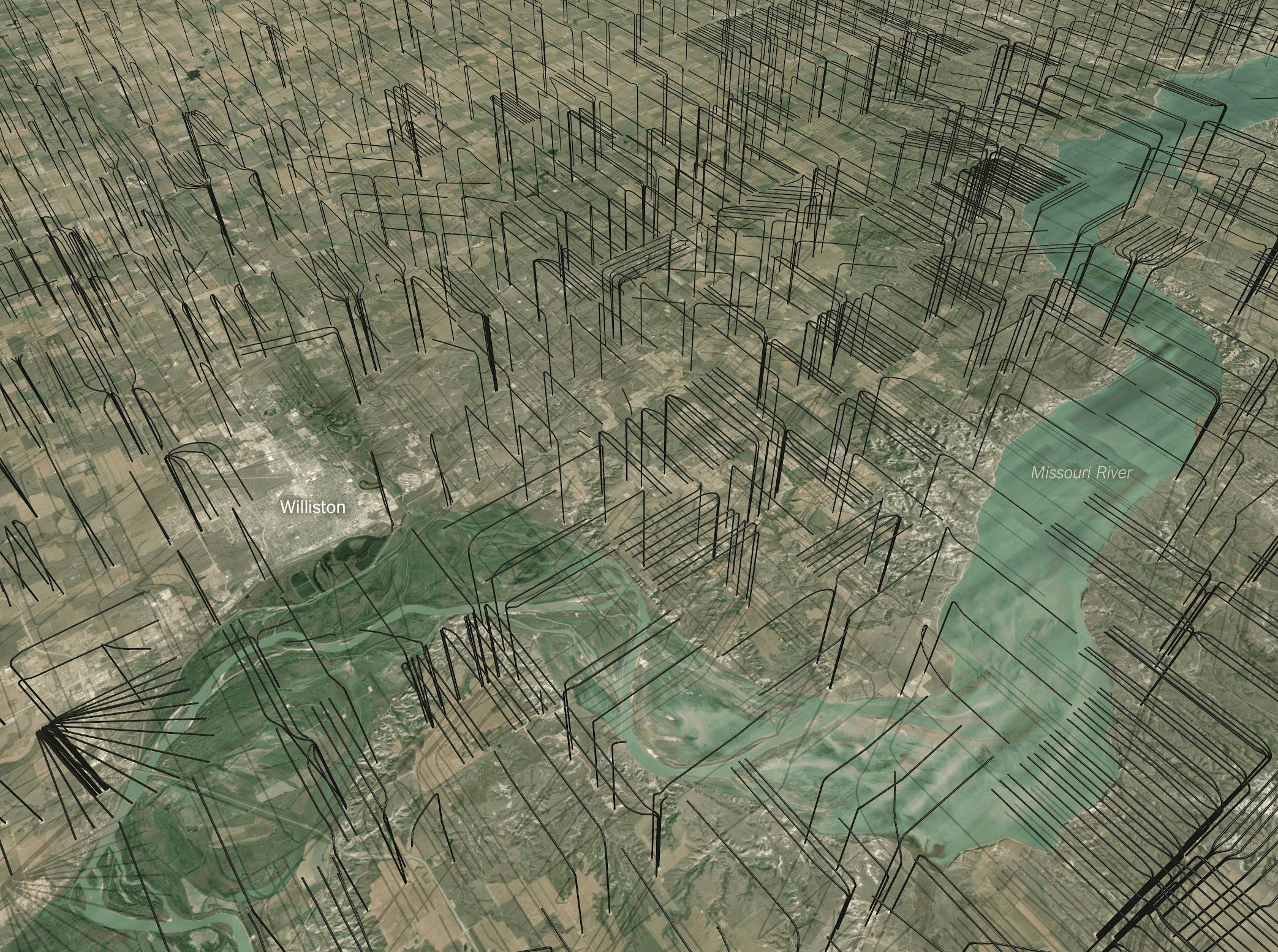
What North Dakota Would Look Like if Its Oil Drilling Lines Were Aboveground
I found shapefiles of exact locations of [oil drilling lines]([object Object]) in North Dakota and thought it would be fun to put them on a map. Unfortunately they all are below ground where they can’t be seen, so I inverted the z direction of all coordinates to put show them above ground.
Appeared on The New York Times